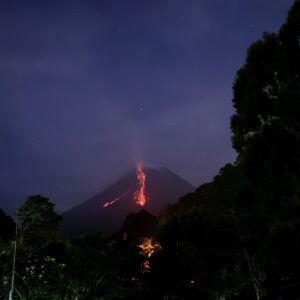
Merapi Volcano is one of the most active volcanoes in the world, spewing lava almost daily. This attracts many tourists to the opportunity to see its molten lava, especially at night.
The problem is the unpredictable weather on the mountain, especially if you’re visiting Yogyakarta during the rainy season. Here are some tips to help you save time.
First, check out the Merapi Lava View Live YouTube channel before leaving (6-7 PM is the best time). There are several live camera locations. If the view is clear and the molten lava is visible, it’s time to leave. Sometimes, not all locations have clear views, so ask your driver for a good viewing point. Jogjatripperhas some view points that people don’t usually visit if necessary.
Secondly, you need a good camera or phone. The view point can vary from 4 – 6 km away, sometimes with not really good visibility that naked eyes cannot really see clearly.
Today, April 10, 2026, the world commemorates 211 years since the peak eruption of Mount Tambora on Sumbawa Island shook human civilization.
In 1815, this volcanic activity reached its most devastating phase, sending ash 32 kilometers into the atmosphere and flowing molten rock that incinerated surrounding villages.
The explosion is recorded as the most powerful eruption in human history, ranking at a seven out of eight on the U.S. Geological Survey’s Volcano Explosivity Index.
The impact not only destroyed local geographic maps but also altered the physical structure of the mountain, shrinking it from a height of 14,000 feet (4,267 meters) to just 9,000 feet (2,743 meters).
Although thousands died instantly from pyroclastic flows, history records that the true horror began when the volcanic ash spread across the globe.
A crucial question arises behind this grim record: did secondary impacts such as climate change and epidemics actually claim far more lives than the explosion itself? How could an eruption in the Dutch East Indies (now Indonesia) create a “year without a summer” in other parts of the world?
Mount Tambora map (163 km from Komodo Island)
The Chain of Death from Crop Failure to Global Pandemic
Data from History and National Geographic shows a stark difference between the number of direct and indirect victims.
Instantly, approximately 10,000 to 12,000 people on Sumbawa Island died from pyroclastic flows, toxic gases, and a moderate tsunami triggered by the collapse of the volcano.
However, in the following months and years, the death toll skyrocketed, reaching an estimated 71,000 to 121,000 in the surrounding region due to post-eruption starvation and disease.
Gillen D’Arcy Wood, author of Tambora: The Eruption That Changed the World, cites even more dire figures when considering the long-term global effects.
The “Year Without a Summer” in 1816 saw severe climate abnormalities, including summer frosts and snow in New England and Europe, caused by the 1815 eruption of Mount Tambora in Indonesia. This volcanic winter led to widespread crop failures, famine, and food riots across the Northern Hemisphere.
Key Facts About 1816:
Cause: The April 1815 eruption of Mount Tambora was the most powerful in recorded history, releasing massive amounts of ash and aerosols into the atmosphere that dimmed the sun.
Global Impact: Average global temperatures dropped by 0.4 – 0.7ºC (0.7 – 1.3ºF)
Regional Effects:
North America: Snow was reported in June in New England, and frost persisted through summer, destroying crops.
Europe: Cold, rainy weather led to massive crop failures and the “last great subsistence crisis” in Western history.
Asia: The monsoon season was disrupted, causing floods, while in China and Taiwan, cold weather/snow was reported, causing famine in Yunnan.
Historical Impact: The famine and economic hardship sparked food riots and, in Germany, encouraged Karl Drais to develop the “running machine,” a forerunner to the bicycle. The gloomy weather also inspired Mary Shelley to write Frankenstein.
Duration: By 1817, the atmosphere had cleared and weather patterns largely returned to normal
Sikunir Hill is a tourist attraction located in Sembungan Village, Kejajar District, Wonosobo Regency. It sits at an elevation of 2,300 meters above sea level. It also offers a variety of mountain views directly visible from the summit, including Mount Sindoro, Mount Prau, Mount Sumbing, Mount Merbabu, Mount Merapi, Mount Lawu, Mount Slamet, and other mountainous areas, all visible on clear days.
One of the most captivating panoramas is the golden sunrise. It was once said to be the best in Southeast Asia. To enjoy the beauty of the golden sunrise, visitors are advised to climb between 4:00 and 5:00 a.m. Sikunir Hill also has a camping area for tourists who want to linger longer.
Climbing Sikunir
Climbing Sikunir Hill is relatively easy, thanks to the well-maintained footpath. There’s also access through stairs, equipped with iron handrails to prevent slipping while ascending or descending. Safety guards and signage leading to the summit are provided along the path.
Although it may seem easy, tourists should not underestimate the climb. The trail requires good physical condition. Visitors are advised to wear a jacket, gloves, or head covering to ward off the piercing cold. They can also bring snacks to enjoy along the way.
The climb to Sikunir Hill takes approximately 30 to 45 minutes. For climbers who prefer a leisurely pace, the climb will take about an hour. The exhaustion of the climb is rewarded by the view of the golden sunrise that greets visitors at the summit of Sikunir Hill.
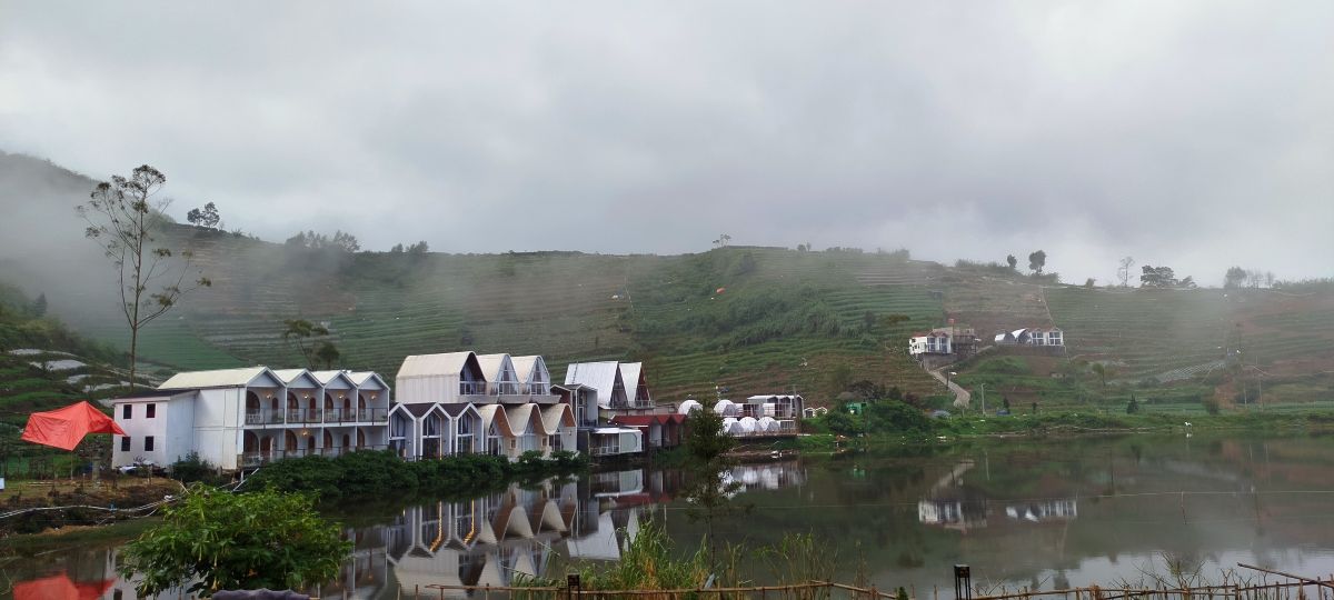
The glowing golden hues in the sky will erase fatigue and make visitors reluctant to leave. The summit of Sikunir Hill is quite wide, so climbers don’t have to worry about crowds. Another panoramic view directly below Sikunir Hill is Telaga Cebong.
Dieng – Telaga Cebong
The best time to climb Sikunir Hill is during the dry season, especially from June to September, when the weather is clear and the chances of seeing the Golden Sunrise are highest. The ideal time to climb is from the Telaga Cebong parking area at 3:30–4:00 a.m. WIB to reach the summit before sunrise, around 5:30 a.m.
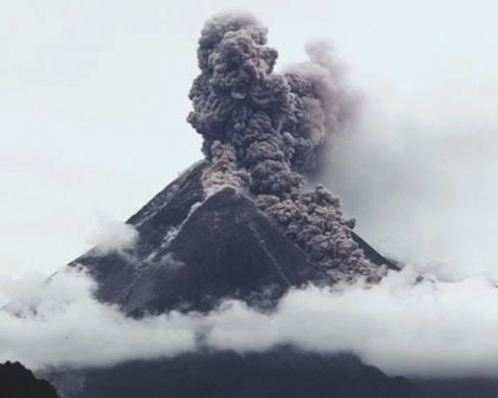
No one expected the 2010 Merapi eruption would be so devastating. Residents along the slopes of Merapi were accustomed to eruptions.
They had lived with them for decades, with eruptions occurring almost every year-round. But in 2010, Merapi erupted millions of tons of hot material, its largest eruption in 100 years.
The government at the time had ordered all residents within the danger zone to evacuate.
The 2010 Mount Merapi eruption caused many deaths due to several powerful and unexpected volcanic hazards around Mount Merapi.
Extremely Powerful Eruption
The 2010 eruption was one of the largest in over a century. Explosive blasts sent ash clouds and volcanic material high into the atmosphere.
Merapi eruption 2010
Deadly Pyroclastic Flows
The most dangerous factor was pyroclastic flows—super-hot clouds of gas, ash, and rock moving up to 100 km/h. Temperatures can exceed 600°C, destroying everything in their path.
Larger Danger Zone Than Expected
Scientists initially estimated a smaller danger zone, but the eruption became much stronger, sending pyroclastic flows farther than predicted, reaching villages outside earlier evacuation areas.
Some Residents Refused to Evacuate
Some people stayed behind to protect homes, farms, and livestock. Others trusted spiritual guardians like Mbah Maridjan, who also died during the eruption.
Dense Population Around the Volcano
Thousands of people live on the fertile slopes of Merapi because volcanic soil is very good for farming. This high population density increased casualties.
Nighttime Eruptions
Several major eruptions occurred at night, when evacuation and visibility were more difficult.
These are 3 best sunrise spots in Yogyakarta recommended by jogjatripper that will boost your mood and energy level.
Borobudur
Borobudur temple offers a sunrise experience like no other. Imagine yourself standing on the top of the biggest Buddhist temple in the world in a quiet and peaceful dawn with the background of valleys and mountains in a distance. It instantly makes you feel like go back to the ancient time. Get an exclusive Borobudur sunrise and Prambanan tour here.
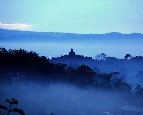
The hill nearby Borobudur
There are two hill sunrise spots : Punthuk Setumbu and Barede Hill. Overlooking Borobudur about 2 kilometers away, both hills offer the same beauty. While Punthuk Setumbu is more famous that’s also more crowded, Barede has less visitors. Get a Borobudur sunrise tour from the hill here.
Sunrise near Borobudur
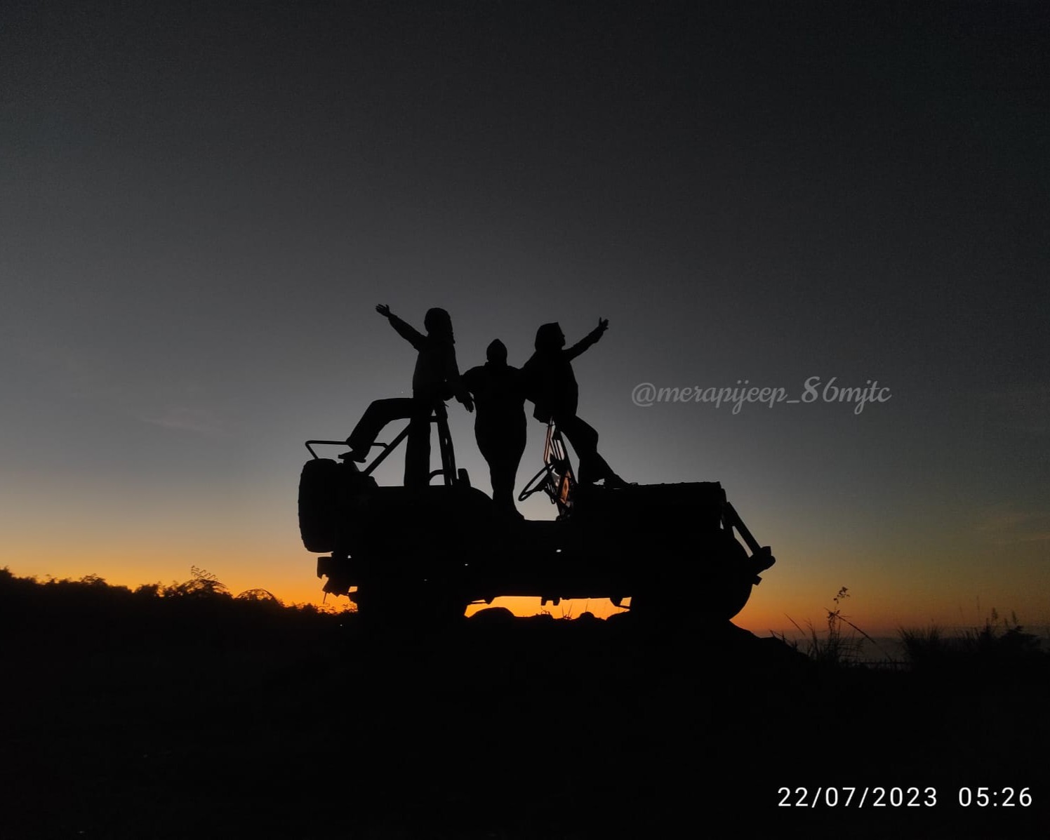
Merapi volcano
Merapi volcano is the most active volcano in Indonesia up until today. The sunrise spot is around 5 km away from the summit, near the bunker. This is included with Jeep tour that visits the bunker and the mini museum which was a house destroyed by the big eruption in 2010. Get a magnificent sunrise volcano tour here.